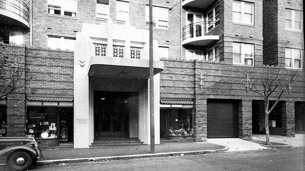
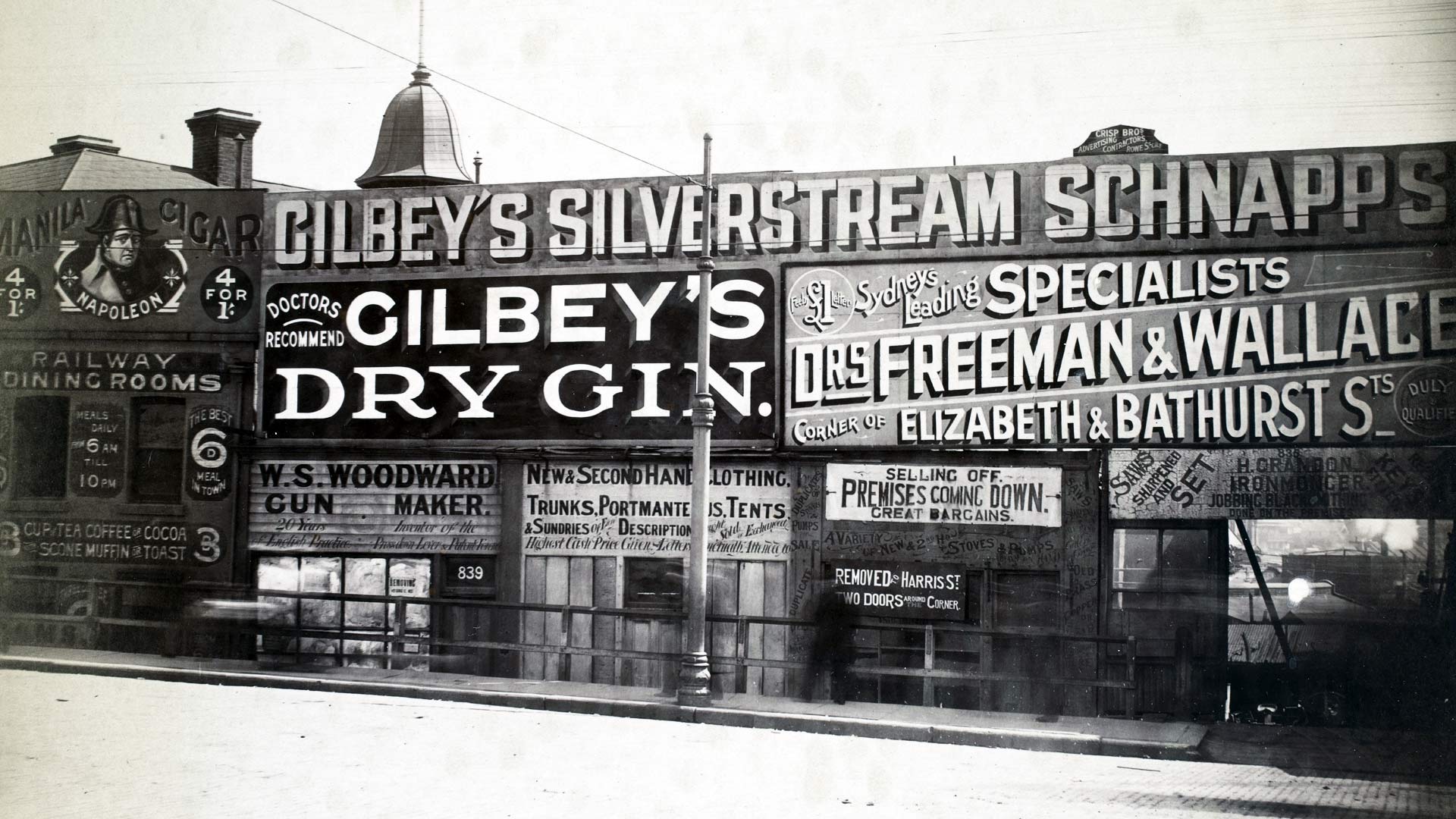
Skip to content

Table of
Contents

Searching for the history of a particular Sydney building? Looking for information about the home an ancestor lived in?

The City of Sydney Archives contains a wealth of information about Sydney’s households and buildings dating back to the mid-19th century.

This house and building histories guide will lead you through many of the resources available to research the history of your house or apartment. It is intended for residents of the City of Sydney's local area.

01

Locating your house in the local area

Where is it?

An important first step in researching a property is to locate it within the current City of Sydney local government area (LGA).

There are several things you need to know about your building before you can start using the historical records efficiently:

  • your street name and house number (be aware that street names and numbering sometimes change over time)
  • your municipality and ward
  • the county and parish in which you live (most useful for land title research)

Street names and house numbers

Street names and numbering sometimes change over time. You can check for altered street names on the Sydney street names guide.

Changes in street numbering will become clearer as you proceed with your research.

Former municipalities

From the time the City of Sydney was incorporated in 1842 its boundaries have expanded and shrunk in an endless game of political football played by the colonial and state governments. In 1842 the area covered by the City of Sydney was just over 11.5 square kilometres. In 1989 it was reduced to its smallest size of just over 6 square kilometres. Today (2015) it is 25 square kilometres.

From 1842 until the early 20th century, the original boundaries remained the same, except for an expansion to take in Moore Park in 1870. Around the edges of the city centre, suburban areas were incorporated as municipal councils from 1859 through the 1860s. Changes to Sydney Municipal Council’s boundaries as a result of taking over responsibility for these suburban areas began in 1909.

You need to know which municipality your home has been part of in order to access the right records. See Council boundaries for a timeline and maps that can be used to establish whether your house was once in a different municipality. If it was in a different municipality, then make a note of when. This information may lead you to investigate the records of councils other than the City of Sydney.

Camperdown, Glebe, Darlington, Newtown, Erskineville, Alexandria, Waterloo, Redfern and Paddington were all once separate municipalities. While all of these former municipalities are now wholly or partially within the City of Sydney LGA, many of them were also once part of other local government areas including South Sydney, Leichhardt and Marrickville.

Wards

For many years the City of Sydney and the other municipalities were divided into wards. A ward is an electoral area, and at local elections residents and ratepayers voted for aldermen to represent them. As populations changed, ward boundaries were often adjusted. It is important to know which ward your property was in at different times.

An interactive map allows you to establish the relevant historic wards for your property in the City of Sydney municipality over time. You can also access a static map series of ward boundaries.

For amalgamated municipalities, you can determine the wards by looking at the municipal maps in the Higinbotham & Robinson Atlas of the suburbs of Sydney.

Before you start

Before you start researching your house history, there are a few things you should do.

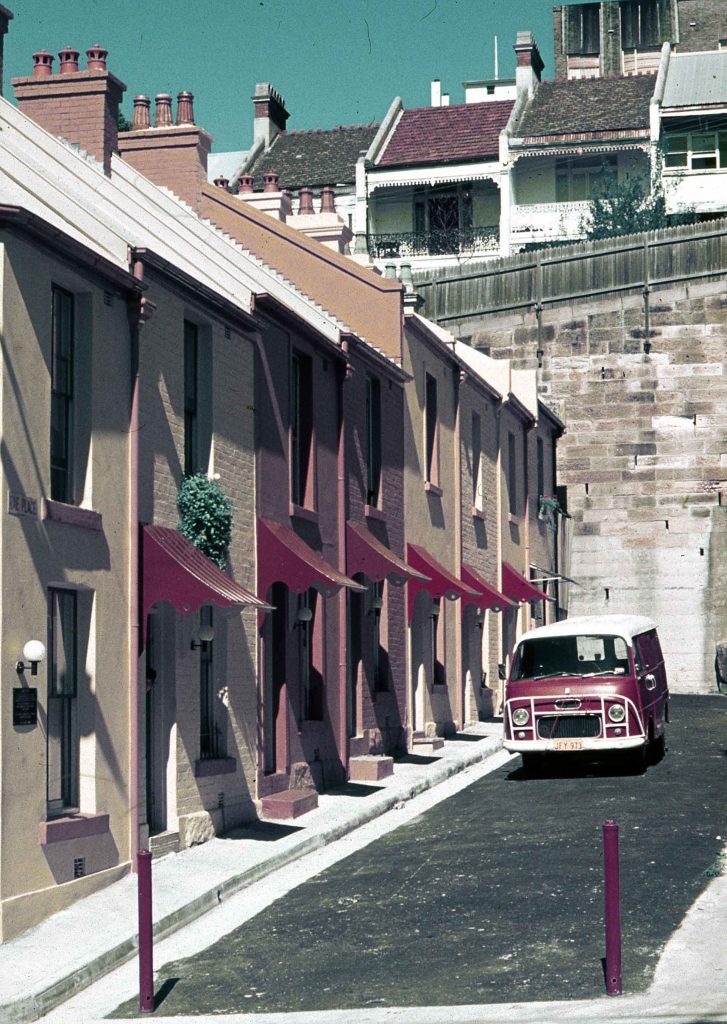
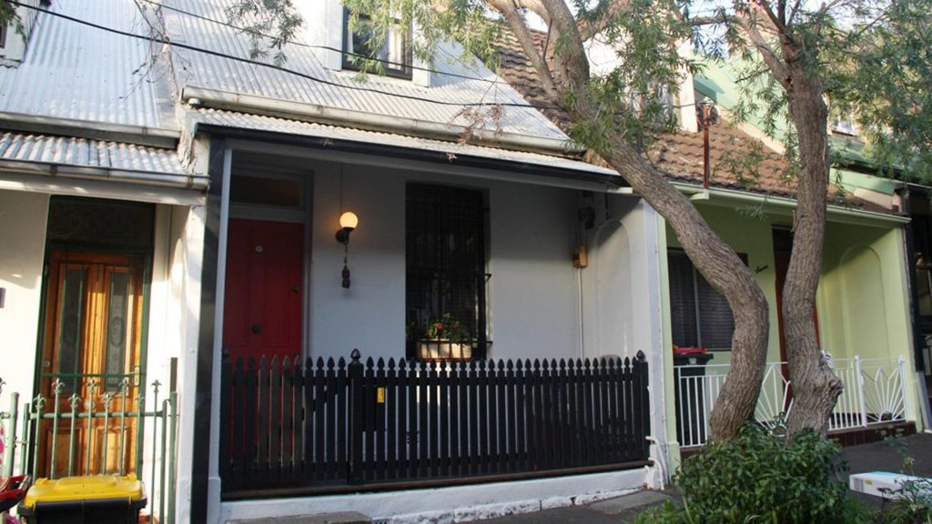
First, establish the approximate age of your house through its architectural style.

Secondly, take time to talk to the neighbours – you will never know what they know unless you ask.

And finally, find out some of the local history of your area. This will give you an understanding of how your local area developed and why your home was built there. A good place to start is the More House History Resources page.

A few other questions

Was your house always a house? Was there a time when it was subdivided into flats or run as a boarding house?  Was it originally a warehouse or factory? Different uses generate different kinds of records.

Was your house or apartment the first one on the site? If your house is an old house, it is possible there were older structures on the site before it was built, especially in areas like Surry Hills, Darlinghurst, Chippendale and Darlington.

Your house in context

Some will only want to know about the previous owners and occupants of their house, while others want to know about structural alterations, additions and demolitions. As you start research, you may want to know more about the character of the area, the street and the neighbourhood. If you read some background history of your area, you will be surprised how much easier it will be to make sense of the specific information you find about your own house.

Check out the City of Sydney’s library catalogue for published histories of your suburb. The Archives and History Resources catalogue lists conservation management plans and heritage studies for houses and apartments throughout the City of Sydney local government area. If these exist for your home, or for places near where you live, they will provide useful historical context.

The City’s historians have also curated a series of Trove lists for suburbs within the City of Sydney. These lists bring together a range of source material, published and digitised, providing a good overview of each suburb. Access these suburb lists through More House History Resources.

02

Maps and Plans

Historical maps are a rich source of information when you are researching your house history. Maps often contain information about your house or local area not available elsewhere.

Research tips

  • Maps cover different time periods and come in different formats so consider how you will organise the various map downloads, links, PDFs and printouts.
  • Putting your maps in date order enables you to see how your suburb and street evolved, but it is often easier to start in the recent past and work backwards.
  • Printed maps can appear online in more than one repository and they may have differences. For example, they may have handwritten notes or updates added at dates subsequent to publication. The same map may also be in better condition in a different repository.
  • Maps can be complicated and may need special skills to 'read' them. Reading the support and help files on the various websites will enhance your ability to use these resources correctly.

Maps

There is a broad array of maps covering the City of Sydney local government area which trace its evolution from the first European settlement to today. Many of these maps are now online. Below are listed some of the key map collections available online. This list is also available on Trove.

  • Historical Atlas of Sydney
    The Historical Atlas of Sydney provides access to the key maps and map series held by City of Sydney Archives. The maps range from the 19th and 20th centuries and were produced variously by Council itself, other government authorities or private surveying firms and individuals. The historical atlas also provides background to Council’s evolving boundaries from 1842 until today. New content from the City’s archives will be added over time.

  • City Boundaries 1842–present
    This timeline can be used to be establish whether your house was once in a different municipality over time.

  • City Wards 1842-1988
    These maps can be used to establish whether your house was in different wards over time. You need to know the ward to be able to search the assessment books. There is also an interactive map of historic ward boundaries.

  • Atlas of the suburbs of Sydney
    Published by Higinbotham & Robinson, this is a useful series of municipality maps dating mainly from the late 19th century. The City Archives holds a set of these maps (AS-1193). They are digitised, but not as yet incorporated within the Historical Atlas interface. You can also access this map series through the Dictionary of Sydney and the National Library of Australia.

  • Video Guides
    There are video guides illustrating the range of maps and plans held in the City Archives. The videos demonstrate how to search and access these collections.

  • National Library of Australia maps
    The National Library of Australia's map collection includes over 600,000 maps, from early European charts to current mapping of Australia, in print and digital form. There are a number of subdivision plans of Sydney in the collection.

  • Search the NLA's Map Collection
    This guide provides advice on how to search for maps in the National Library of Australia's catalogue.

  • State Library of NSW map collection guide
    This guide to the State Library of NSW's maps collection will help you find and use maps in their collections, both online and in the library. The guide covers finding and viewing maps, getting copies, and information about significant maps in the collection. You will also find online resources for learning more about maps.

  • State Library of NSW Sydney by Decade maps
    This timeline is a useful introduction to some of the key digitised maps covering Sydney.

  • Sydney Metropolitan Detail Series
    The Sydney Metropolitan Detail Series (1880-99) is particularly useful for researching house histories. Make sure you look at the key maps first.

  • Sydney Block Plans
    Detailed block plans from the late 19th century and early 20th century are a rich resource for historians. They allow us to research former buildings, visualise the streetscape and reconstruct the city landscape. This Trove list links to key Sydney Block Plans that have been digitised and are available through the City of Sydney, State Library of NSW, and National Library of Australia.

Subdivision plans

Subdivision plans are a rich source of information for the house historian. Subdivision plans are held at a range of repositories including the State Library of NSW, the National Library of Australia, the City of Sydney Archives and Land and Property Information (LPI).

A selection of digitised Auction and Sale Lithographs 1865-1935 for the city area is available on Archives and History Resources.

A Plan Book from Alexandria Municipal Council has been digitised. It contains some subdivision plans for the district, along with engineering drawings relating to the formation of roads in Alexandria.

To find subdivision plans in the State Library of NSW catalogue, type the name of your suburb. Some of these catalogue records include a list of all the subdivision plans held for that area including their date and street boundaries.

Some subdivision maps and plans held at the National Library of Australia are also digitised. Search the catalogue using the keywords subdivision plan and the name of your suburb; narrow your search to maps.

Parish Maps

NSW Land Registry Services is responsible for the legal registration of documents relating to ownership of land and property in NSW.

Historical land ownership was recorded on parish maps. These maps are essential records of early land ownership in NSW.

It is important to know the county and parish in which you live to use the land title records. Everyone in the City of Sydney local government area lives in the County of Cumberland.

The parishes within the County of Cumberland are:

  • Petersham
  • St Andrew
  • St Philip
  • St Lawrence
  • St James
  • Alexandria

To find out what parish your property is located within, you can check your current title, or you can use the Geographical Name Register to search by suburb. Information provided will include the parish name. The county and parish names and boundaries have not altered since they were established.

The NSW Land Registry Services Historical Lands Records Viewer is the online tool you can use to access digitised historical parish maps, along with thousands of other digitised plans, land titles and indexes.

To understand the range of digitised land records available through the Historical Lands Records Viewer (HLRV), along with tips and access, see the NSW Land Registry Services list of Historical Records Online and their search guides. An explanation of parish maps and how to use them (PDF) is also available from NSW Land Registry Services.

The State Library of NSW has produced a 4-part webinar called Historic Land Records Viewer (HLRV) Fundamentals. These videos introduce the major record series contained in HLRV, including Old System grants and title deeds, Torrens Title and parish maps. Highly recommended viewing before leaping into the HLRV.

The County/ Parish Maps Guide from NSW State Archives provides an overview of county and parish maps, which may also help you to understand the parish maps now available on the NSW Land Registry Services Historical Lands Records Viewer.

Find out more parish maps and other maps and plans held in NSW State Archives list of maps and plans.

03

Post Office Directories

What is a post office directory?

Post office directories like the Sands directories, are best thought of as a precursor to telephone directories and a rudimentary street directory rolled into one. They combine alphabetical name listings, suburban street listings and business listings that help identify people or businesses who once lived or worked at your address. A number of commercial firms published post office directories.

This section of the house and building histories guide explains how to use the Sands directories, the most widely used postal directory for Sydney which has been available on microfiche for many years and is now available online.

Please note, post office directories published by other commercial firms often have comparable material and some of their date ranges are not covered by Sands.

What is a Sands directory?

Sands post office directories, which were sometimes called Sand's Sydney Directories or Sands Sydney and Suburban Directories, were published by the John Sands stationery firm from 1858 until 1933 and appeared every year, except 1860, 1862, 1872, 1878 and 1881.

There are 68 volumes, each increasing in size from the previous one as the population of Sydney and NSW increased.

What does a Sands directory contain?

Each directory contains several sections:

  • A street directory, which provides an alphabetical list of streets, first for the City of Sydney and then for surrounding suburbs, with name and occupational information against each address. If a house was named, this may also be listed.
  • An alphabetical list of residents' names with addresses.
  • A directory of trades, commercial companies and organisations, and professions. An equivalent of today's Yellow Pages.
  • Various other commercial, government and institutional listings.

What does a Sands directory tell you?

  • The names of people who lived in the house.
  • The occupations of residents (sometimes).
  • The economic uses of the building – for example, the house/apartment may have previously been a shop or a factory.
  • Previous structures on the site – for example, in the case of a new apartment building.
  • House name (if any).
  • Approximate construction date of a house or buildings.
  • Changes in street numbering.

What does the information mean?

Directory information was gathered in door-to-door surveys where whoever answered the door gave information to the collectors. There would have been no reason to lie or evade answering questions but there are no entries for housebreakers or prostitutes, nor is there consistent spellings of names. If you find a James Coates living at the address where the previous year there was a James Cotts, it is reasonable to assume it was the same person.

An important function of the directories was to provide citizens with access to tradespeople and commercial organisations. The street address listed will often be accompanied with the name and occupation of the householder, for example, Blair, James, upholsterer or Ah Chong, interpreter. However, don't expect all tradespeople to be listed in the trades section as it was a form of advertising where a fee was paid, similar to the Yellow Pages today.

If no occupation is listed accompanying the name it may be either because the occupier was a labourer, or at the other end of the scale, a gentleman – the house type and its location may however help you decide. Or the lack of occupation information may just have been an omission.

Post office directories list occupiers, not owners. To find out owners' names you will need to consult other sources such as assessment and rates books. Usually only 1 householder was listed for each house although common sense suggests there may have been other breadwinners living in the house, which can be verified by searching the trades section.

When the name given was a woman, it either means there was no male earner or household head, or the place contained a business she was running such as boarding houses, laundries, grocery stores, hat makers and so on. In these cases there may or may not have been a male presence as well.

Some houses were named and these too were often listed but don't expect your house name to have remained unaltered. House names can be particularly helpful in some of the earliest directories when streets were not named or vaguely recorded. In places like Newtown the early directories provide no house numbers because the houses weren't numbered. Houses on large acreages were recorded at the main road they faced. When later subdivisions resulted in new streets, the house remained but the street address changed.

In the 20th century when flats began to be built and other buildings had multiple stories, there were often multiple tenants recorded for a single address. For example, Sands in 1932–33 recorded the names of several businesses and 13 tenants at 9 Bayswater Road, Kings Cross. Other buildings listed with multiple occupants provide only the caretaker's name.

Post office directories took several months to prepare and therefore the information they provide for a particular year often related more accurately to the previous year. For example, a house first appearing in Sands in 1892 may well have been there, or it was at least being built, in 1891. Or a person recorded at an address in 1923 may have already moved on that year but they were living there in 1922, and so on.

Research tips

These research tips will help to ensure you receive the best search results.

  • Always start with the most recent volume, 1932–33 and work backwards. This is due to many places not having street numbers listed in earlier volumes and more importantly, the house number may have changed over time. Likewise, the street name may have changed. Starting your search from the earliest volumes could result in subsequent searches for the wrong house.
  • The approximate construction date of the house can be determined from the previous volume where it was not listed. For example, a house listed in 1932, may not be listed in 1931.
  • In the first instance, it may be adequate to search only every third or fifth year. If the occupier's name and their occupation did not change there is probably little to be gained from searching the years in between. However, you may want to search every year for 2 reasons:
  • Variation in occupation. For example, someone whose occupation changed between carpenter, undertaker and builder, indicates the state of the economy and the individual's position in it.
  • Year by year information can contribute to an understanding of changes in the locality. The occupant of the house may remain the same, but if a factory or hotel is built next door, you may want to know.
  • Always take note of the nearest cross street. This ensures the correct side of the street is being captured and helps to locate a building when the number of buildings on a street is inconsistent. It will also provide information about the neighbourhood. The street where the building is located is listed in bold and the cross or intersecting streets are in italics.
  • Although the focus of research is usually on the details of a particular house, we advise making notes of other information about the locality. For example, it is worth looking across to the other side of the street and around the corner to get a sense of what the immediate neighbourhood was like in past decades.
  • Sometimes a familiar name will appear in a different house. This could be a mistake when the directories were first compiled, or it could be correct. People often moved only a couple of doors down the street or across the road, especially renters.
  • It is worth checking the trades section of the Sands directories for builders to find out who was working in the area when the house was built. This could provide some clues about the builder of the house you're researching, especially if it is in a row of terraces. It was common for small-scale speculative developers to build a terrace row sequentially, including a house of their own that was a bit bigger or fancier than the rest of the row.

Other post office directories

Low’s City of Sydney Directory was published in the 1840s, predating Sands. The 1844-45 edition and the 1847 edition have been digitised by the State Library of NSW. Includes useful listing of trades.

Waugh & Cox’s directory of Sydney and its suburbs, 1855 includes systematic listing of streets and street numbering, as well as an alphabetical listing and trades listing.

The NSW Post Office (and Commercial) Directories, which are often referred to as Wise's Directories started in the mid-1880s and continued until 1950, covering more than a decade after Sands stopped publishing. The Wise's Directories are available in digital format through the National Library of Australia and in hard copy format from the State Library of NSW:

Handbook to the City of Sydney is a complete street directory showing at a glance the exact positions of any given street number or house, including public buildings. It was created in 1879 by Lee & Ross, Sydney.

Wilson's directories which were published for many decades from 1902 contain maps showing rail and tram lines. The 1902 edition has been digitised, but later editions will need to be accessed in libraries.

Sands Directory

You can search the Sands Directory online. The records have been scanned from microfiche into a complete digital edition:

04

Look for Historic Photos

Historic Images

Historical images held at the City of Sydney Archives may show the place where you live. More than 95,000 photos have been digitised and catalogued in Archives and History Resources, and staff are still adding more.

In this video guide, the City Archivist Janet Villata introduces the photographic collection held in the City Archives. Learn how to find photographs in the catalogue, obtain copies and manage and share your favourites. One of the key collections of historic photographs is the Demolition Books, which comprises almost 5000 photographs and associated glass plate negatives. In this video guide, historian Laila Ellmoos explains how and why the collection was created and shares some of her favourite images.

Research tips

  • While you may not find your house, a photo of the street or close by in the suburb will give you a sense of the locality in a particular period.
  • You can filter by photograph as a type to limit your search only to photographs
  • Keyword search street number and street name eg. 76 Ultimo
  • Not all photographs are identified with street numbers. Try searching on the street name only and/or nearby numbers to find more photos in and around your house
  • Try searching without the road type in your search (street, st, avenue, ave etc) as there are many variants.
  • Try searching on the building name or business name; these are sometimes mentioned in the description.

Other collections

Many other libraries and archives have large photographic collections of Sydney, including interstate institutions. The best way to search for photographs across multiple institutions is to use Trove.

Outside of the City of Sydney, it is also worthwhile checking the local studies collection for your local government area. These are usually held in the local council library. For suburbs such as Glebe, Camperdown and Newtown that were previously located within Leichhardt and Marrickville Council areas it is worthwhile checking the Inner West Council local studies collection.

Remember, for the City of Sydney, all photographs are held by the City Archives and identified using Archives and History Resources.

05

Assessment and Rates Books

What are assessment and rates books?

Among the most popular records with researchers, assessment books contain basic information about every property in the City of Sydney that has paid rates in a certain period.

They should not to be confused with rates books. Rates books are less used as they tend to contain less information and they have not been digitised. The rates books may be useful for comparative purposes when there is conflicting information in other sources. While some councils combined the 2 functions in the 1 book, the City kept them separate.

When the City was established in 1842, part of its funding came from rates levied on properties within its boundaries. To determine the rateable value of property, the City's assessors would visit buildings every 3 to 5 years to record:

  • the owner's name
  • the ratepayer's name
  • materials used to build the house - stone, timber, brick, with roof of iron, shingles and so on
  • the number of rooms and levels
  • the type of building – house, public house, shop, factory and so on
  • the building's assessed annual value

Occupants' names weren't usually collected, although some assessors included additional information in the remarks column.

Links

How do I find my property in these records?

You need to ask the following questions to identify the correct assessment book to begin your research:

1. What suburb is my property in?

This will determine which set of council assessment books you need to consult. Tip: Only the City of Sydney assessment books are currently online. Other former municipalities have partial records. See 'What suburbs do assessment books cover?' below.

2. What ward is my property in?

Check the City of Sydney historic ward boundary maps. For other former municipalities, wards are defined on the relevant map in the Atlas of the Suburbs of Sydney.

Tip: Assessments were made by ward, so if a street crossed over ward boundaries, parts of its assessment was recorded in a different assessment book.

Tip: It is possible the ward changed its name and boundaries over time.

What suburbs do assessment books cover?

The City of Sydney rates and assessment books cover the original boundaries of the City of Sydney.

Each book refers to one ward and most refer to 1 year only. Maps showing city boundaries and ward boundaries since 1842 are available online. You will need to consult these maps to identify the relevant ward where your street is located. You need to be armed with this information before you can search the assessment books. We also recommend you read the Guide – City of Sydney Assessment Books to understand how the search functionality works.

The City Archives also holds partial records of the assessments and rates books for the former municipalities (pre-1949) now within the City of Sydney. These are being progressively digitised and are accessed through Archives & History Resources:

You currently cannot search across these records and must drill down in each relevant ward volume and browse to find the street and property.

What time period do assessment books cover?

The City of Sydney was incorporated in 1842. Property assessments in the city and surrounding municipalities were carried out from 1845 until 1948. After 1948, the NSW Valuer General's Department took over the task of assessing property value.

A small number of the City assessment books have not survived. A table summarising the City wards and years where volumes are available provides a useful overview of the series and quick access to the transcripts. The historic ward boundaries also allow you to drill down to a particular volume by ward and assessment year.

As noted above, rates and valuation records of other former municipalities are partial.

What's in the assessment books?

Assessment books usually contain the following information, usually divided into columns. Here are some tips about what this information means and how it was gathered:

  • An assessment book number A property often did not receive the same number in successive assessments. In most books the numbers begin with "1" but for a few years the City used a single sequence of numbers across all books created for a single assessment
  • Situation The term used for street name - usually written vertically on the left-hand side of the page
  • Street number These were not generally in use in the City before the mid 1870s. Where present they are usually recorded for one side of the street at a time. All of the odd numbers will be together, and all of the even numbers will be together. See below for a discussion on the problems associated with street number changes
  • House name These were not recorded in any systematic way. It seems to have depended very much on the assessor. They are more likely to appear in later books
  • Ratepayer's name Until 1879, rates were usually paid by whoever was responsible for paying the rent on a property. After 1879, the ratepayer could be the owner or the tenant. Surnames are sometimes spelled differently in different assessments
  • Owner's name When the owners' or ratepayers' names change, the original entry is often crossed out and the new details written in
  • Property description Usually limited to house, cottage, hotel, shop, or factory. The Sydney Incorporation Act 1842 specified the categories of buildings as "house, warehouse, counting house or shop". These limitations can be frustrating, especially if one suspects a property may have had a use that is not recorded, for example as a lodging-house
  • Building materials A short description of the materials used in the house and the roof such as stone, brick or wood for the house, and slate, iron or shingles for the roof
  • Number of storeys and rooms This can change from one assessment book to the next. For example in successive years the same property can be described as having 2 floors, then 3 floors, then 2 floors again. It is possible that some assessors counted basements and attics as floors and rooms while others did not. In some cases the changes will reflect actual construction work, and this could be reflected in a significant change in the value of the property
  • Annual value Expressed in pounds. The assessed value of the property used to set the rates payable by the owner or occupier
  • Comments Contains a wide variety of remarks. Some assessors comment on the dilapidated state of the property or note that there is a kitchen or stables at the back. Sometimes they note when a property is pulled down

Using assessment books

Within each book assessments are arranged street by street, then building by building, within each street. They are not arranged alphabetically by the names of owners or ratepayers, nor by street name.

The organisation of the assessment books reflects how they were compiled by the assessors when they hit the pavement. Assessors usually started at the northern or western end of a street and walked along the right hand side of the street from ward boundary to ward boundary. They then returned to their starting point and walked along the left hand side of the street. Vacant land was recorded as well as buildings, and any non-through laneways were to be assessed when they came to them. Lanes did not always have an official name. As a result, unnamed lanes often appeared in the assessment books as ‘1 off’, ‘2 off’ and so on, recorded as running off a main street.

Some volumes contain supplementary assessments, updating changes made in the following years prior to the next assessment. Where a supplementary assessment has been carried out, there will be a note in the remarks column with a reference to a later assessment number. The supplementary assessments, found at the end of the volume, usually record changes in ownership, major alterations or demolitions. In some cases, they will describe the property as vacant land.

NB: Supplementary assessments have not been transcribed into the online database, so they cannot be searched by keywords.

Because assessments were carried out only every 3 to 5 years on average, there probably won't be a specific assessment for exactly the date you wish to research. In this case it is best to start at the next assessment and work backwards. This also helps clarify and overcome problems with street number changes, which are discussed below.

Research tips

If you are having difficulties finding a property, there are a number of things you can do:

  • Check the City historic ward boundaries to ensure that you are looking at the correct ward and correct year – remember that ward boundaries change over time, and your property might be in a different ward in different years.
  • Ensure the street existed and hadn't had its name changed. An online guide to City streets and the Sands Directory for the same year can help
  • Has the street number changed? Street renumbering happened frequently in the 19th century. To overcome this go to an assessment for a later date and work backwards towards the date where your research is focussed. The assessment books do not usually reflect changes by crossing out the old number and replacing it with the new one. If there are cross-streets shown, these can help. If you know the position of the property you are searching for in relation to a cross street, you should be able to find the same property again even if the street number has changed. You should also note the names of owners and occupants in neighbouring houses, as some of the names remain fairly constant. Recognising these patterns will usually help you to pinpoint a particular property where street numbers have changed.

There are some steps to help you if you can't find a particular person:

  • The occupants of buildings were not always the ratepayers, and were therefore not recorded. Boarders, lodgers and sub-tenants, and family members other than the head of the family noted as the owner or occupier, were not normally recorded in the assessments. If people moved in and out of a property between assessments they will not be recorded. Spelling can be erratic
  • Gaps in the record such as these can sometimes be overcome by checking through Sand's Sydney Directories (1858 to 1933, which are available at the Archives, and on microfiche in major public libraries

Beyond the assessment books

Other records can be used to supplement information from the assessment books, or to cover the years after 1948. They are available at the City Archives.

06

Historical Building and Development Applications

Building and development applications

The City of Sydney Archives maintains records to building and development applications, as well as other property records, including subdivision files. Some of these records date back as far as 1909.

Building and development applications were generated for properties if an application was submitted (DA) and building work carried out (BA). If there is to be a change in use of a building, a DA was, and is, required. DAs cover what was proposed by the applicant and was approved by Council. BAs cover the erection of a building and alterations to it. If these records survived and were archived, they will be available for access.

Consent documents, such as approved uses of buildings, are normally found on the files relating to a building.

City Archives do not have application records for every building in the city. They will only be available if an application was submitted to the City and the records have survived and been archived.

What does a BA or DA tell you?

  • the name/s of the previous owner
  • the previous use/s of the building
  • current use at time of application
  • the name of the architect/s
  • a description of the works to the building
  • the cost of the works to the building

Applications may also include plans, relevant information about the surrounding area, building inspectors' and surveyors' reports, Council decisions concerning the application, correspondence and inspectors' reports about the work when carried out. Occasionally, a photograph may be attached to a file.

Search across development and building records

The archivists have brought together many of the key records that cover development and building applications into one collection to make it easier for you to target your research.

You can search this collection. The search on this page will only return items within this collection. It will search the title and descriptions of the records only.

It is important to note that to view any available content of development and building files you need to be registered as a member of Archives & History Resources and logged on.

Key record series

The main records series covering building and development applications in the City of Sydney are:

Council kept registers and written descriptions of the BAs from 1879, but it appears it did not start creating files until 1908. Many of the early records have been culled – early BA descriptions and pre-1940s BA files were destroyed in the 1950s and 60s. DA files are held from 1954. Approved building plans date back to 1909.

Development consents may also be available in the printed annual volumes of the Proceedings of Council. Development consents are published from 1946.

Registers

City Archives holds registers which relate to building and development applications. So even if the application file does not survive, you may find some information in the registers.

Before computerised systems were introduced, all BAs and DAs were indexed by street address in the planning street cards. See Section 07 Planning Street Cards for more information for what is contained in this series.

Absorbed councils: BA and DA files, registers and plans

We also hold records, application files, registers and plans relating to other council areas which have been absorbed into the City of Sydney. Many of these are captured in the Development and Building collection search. Check the records listing for each municipal council in Archives and History Resources to see exactly what records are held:

Search tips

All the available property application records (plans and files) held by City Archives up to the late 1970s, and in some cases the early 1980s, are listed in our online catalogue Archives and History Resources.

Key series relating to building and development have been curated into the Development and Building Collection. The search on this page will only return items within this collection - it is a targeted search of selected records. It searches the contents as well as descriptions of files. To fully understand exactly the records included in this collection see the Subject Guide to Records of Development and Building.

Try search terms such as a property address. For example, '12 George' or a person’s name. Do not include terms like 'street', 'st', 'road', 'rd'.

More Recent Records

Recent records are catalogued and held in active files. You can try the online DA Search. Plans for recent decades may be held in the active files of Council. Our archivists can advise.

Access to the records

All of these records are available from City Archives. To arrange access contact City Archives to make an appointment.

07

Planning Street Cards

Development history

Planning street cards provide information about historical building and development applications from about 1908 to the 1990s. Until 1945 only building applications appear on the cards. Development applications were not required by law until after 1945.

If a house was altered, extended or underwent a change of use, chances are there will be a street card for the property. Keep in mind though, just because a BA or DA was submitted and noted on a street planning card, it doesn't mean the works were approved or the works went ahead.

The street cards show all the applications submitted to the City of Sydney, even if original files and plans no longer exist. To see if certain records have survived and are available you will have to check Archives and History Resources. Ask the archivists for records made after 1987.

The street cards have been separated into sets because they became divided between different councils as municipal boundaries changed. For many decades, the City's local area boundaries covered a much smaller area than now, and it was smallest of all between 1988 and 1994. A set of maps showing city and ward boundaries since 1842 is available online in the Historical Atlas of Sydney.

The planning street cards have all been digitised. Each set is arranged alphabetically by the names of the streets in the area covered by the cards. Within each street, cards are arranged numerically by street address. The cards are not always in perfect order so it can pay to scout around within the set. Some streets with lots of cards are subdivided into sections, for example, by odd and even street numbers.

City 1907 to 1928

Records for the City 1907 to 1928 are in series AS-0710.

City 1928 to 1994

This group does not cover areas transferred to other councils in 1968 and 1988. This set of cards is archival records series AS-0533.

South Sydney 1929 to 1988

South Sydney City Council was created in 1988 and these records were transferred to the organisation. This set of cards covers streets located within South Sydney Local Government Area (1988 to 2004). All street planning cards in the set for this area date back to 1929, which is a part of archival records series AS-0533.

Newtown 1949 to 1968

The cards for Newtown 1949 to 1968 cover the part of the suburb transferred to Marrickville Council in 1968. The cards cover only the period (1949-1968) when the City managed this area.

Paddington 1949 to 1968

These applications are for Paddington streets in the area transferred to Woollahra Council in 1968. The cards cover only the period (1949 to 1968) when the City managed this area.

Glebe 1949 to 1999

The cards for Glebe 1949 to 1999 cover the period from 1949 (when Glebe was incorporated into the City). The cards were created by Leichhardt Council some time after 1968, so pre-1968 information may not be complete. This set is records series AS-0533; AS-1099.

Building Inspectors’ Cards

Related to the Planning Street Cards are the Building Inspectors’ Cards. These cards provide a quick overview history of each building application received by the City of Sydney Council. If a building application was approved, a building inspector carried out periodic checks to ensure the work was in line with the approval. These cards summarise the building application and works.

Each card has fields to record the building application number, names of the applicant, architect, builder and engineer, the location of the work, estimated cost, a description of the work, dates of approval or disapproval, dates and details of inspections, and the date of completion of the work. Not all fields are filled in.

The majority of the Building Inspectors’ Cards date from 1941 to 1997. They have been digitised and can be searched in Archives and History Resources by address. They are also captured within the Development and Building collection.

Since building application files dealing with minor works from the period 1941-1978 were destroyed in 1982, these cards (along with the plans in the series Building Application Plans AS-0126) are a valuable summary of building modifications.

08

Architectural and Building Plans

The main type of plans held in the City Archives are architectural and building plans, both proposed and approved building plans. Many are associated with building and development applications, and the majority date from the 20th century. The plans can be hand-coloured prints, linen tracings or blueprints.

We also have in the archive collection engineering plans, building survey floor plans, land auction sale plans, trigonometrical surveys and detail sheets.

A significant number of architectural plans have been digitised or partially digitised. The project is ongoing, and eventually all the plans will be completely digitised. The plans have been indexed on Archives and History Resources; you can search by address. Many are also contained with the Development and Building collection.

Digitised plans can be downloaded as pdfs from the catalogue for free.

Tip: remember, some proposals were not approved. The plans only show what the developer or owner wanted the council to agree to. Look for a stamp or annotation to see if the plan was approved.

A separate section in the guide explains records associated with building and development applications.

City of Sydney application plans

From 1909, Council required duplicates of plans to be attached to Building Applications. These plans can be ornate, detailed architectural drawings, elevations and sections or they can be rough sketches for minor alterations and additions.

Over the years the plans submitted with the average building application have increased in number. At first only architectural drawings were lodged, mainly elevations and floor plans, and the total number of plans per application rarely exceeded ten. As structures and techniques grew more complex other plan types were introduced. Today engineering, electrical and mechanical drawings form the bulk of the submitted plans.

There are over 46,000 plans in this series.

The plans have been indexed on Archives and History Resources; you can search by address. They are also contained with the Development and Building collection search. The plans are digitised as PDFs and can be downloaded individually.

Recent records

For development applications that were lodged after 8 November 2004, you should first try the City of Sydney’s online service Find a DA.

Amalgamated council areas application plans

Similar sets of plans associated with building and development applications have survived for amalgamated council areas, although the collections are not comprehensive and do not cover all buildings. Digitisation of these series is ongoing. They are all included within the Development and Building collection, as well as being indexed on Archives and History Resources; you can search by address.

City Architect and Building Surveyor Department plans

There are two major records series containing architectural plans drawn by City of Sydney Council’s architects. These plans include buildings, markets, hotels, public housing, sporting facilities, substations, street furniture (garbage bins, lamp standards etc), public conveniences, community facilities, playgrounds and incinerators.

The plans are a range of formats including hand-coloured prints, linen tracings or blueprints and occasionally are signed by the Town Clerk and the contractors carrying out the building work.

The earliest plans relate to Sydney Town Hall and the Exhibition Building in Prince Alfred Park. The plans of some key buildings have been extracted as their own series.

All of these plans have been indexed on Archives and History Resources.

Building Survey Cards

These cards were prepared by the City Architect and Building Surveyor’s Department. They contain a detailed summary of a building’s type and construction. Importantly for history researchers, most of the cards have a hand-drawn sketch of the floor plans of each building attached. The cards are usually signed and dated by the Council officer carrying out the survey.

There are two sets of building survey cards, completed at different times, which provide a snapshot of a building in a certain era.

The cards have all been indexed on Archives and History Resources; you can search by address. They are also contained with the Development and Building collection.

  • Building Survey Cards I (AS-0932)

Most of the cards in this survey are for surveys completed in 1944 and 1949.

Each card records most of the following information: address; building name; type of business or activity; number of floors; number of personnel; construction type; roof materials; height; floor area; dimensions and material of stairs; fire escapes; number and type of lifts; light areas; number and type of sprinklers; fire doors; interconnected buildings; adjoining lanes; meters; ventilation; floor loading; type of motors used; existence of air raid shelters (ARS); number and location of toilets; windows; floor plan(s).

Building footprints

Several maps digitised and accessible within the Historical Atlas show accurate building outlines. Compared over time, these maps can point to building modifications.

  • Trig Survey, 1855-1865 - shows building footprints and construction materials
  • Dove’s Plans, 1880 – shows building footprints, number of storeys, construction materials
  • Rygate & West, 1888 – shows building footprints, number of storeys, construction materials
  • Fire Plans 1917-1939 – shows building footprints, number of storeys, stairs, lightwells, construction materials
  • Civic Survey, 1938-1950 – shows building footprints, number of storeys
  • Glebe Municipality, 1939 – shows building footprints
  • Detail Sheets, 1949-1972 – shows building footprints

The Historical Atlas is accessible through a tile on the homepage of Archives and History Resources.

Video Guide

For further direction, take a look at our video guide on Plans in the City Archives, part of our series The Things We Keep. City Historian Lisa Murray highlights some of the gems in the collection and will guide you to find plans of interest to you.

09

Correspondence

Letters, reports and memos were the chief form of written communication throughout the 19th and 20th centuries. You can often find documentation about buildings and the people who occupied them in the vast quantities of correspondence held in the City Archives.

Letters were written to the Council by Sydney residents, business owners, organisations and charities, colonial government departments, as well as people and organisations across the country and around the world. The letters canvas all sorts of subjects related to council operations and the inner city. You won’t find a private letter from your great-grandmother to her sister in our archives, but if your ancestor lived in the city or had a business in the city you might find them writing a letter to the Mayor or the Town Clerk. These letters are a treasure trove and give us a unique and intimate insight into daily life in the city.

19th century correspondence

Sydney Municipal Council was formed in December 1842 and we have letters in the City Archives dating back to that time. As well as letters from individuals, there are a lot of petitions with multiple signatories. These were often submitted by local residents when they were lobbying for improvements in their immediate vicinity, eg. Better street lighting, cessation of a smoke nuisance, better drainage etc.

The good news is that the entire series of Letters Received 1842-1899, over 57,600 letters, has been digitised and individually catalogued in Archives and History Resources. Digitised letters can be downloaded free of charge.

You can try searching by a person’s surname, or a street address, a business, or even a subject.

A keyword search and filtering to focus on the Letters Received series is the best way to explore this series.

For further direction, take a look at our video guide 19th century letters in the City Archives, part of The Things We Keep series. City Historian Lisa Murray demonstrates how to search these letters and highlights some of the surprising things you might find.

20th century correspondence

In the 20th century, correspondence files were established for particular subjects. These can relate to applications for approval about particular properties.

Unlike most other councils, the City has not created general purpose property files for each street address. However, such files do often exist for the areas of Glebe and South Sydney that are now within the City’s boundaries. These files are available from 1941 to the present day.

While some DA files from the 20th century may not have survived, you still may discover correspondence relating to the proposals, especially if the development proposal was large or complex. These are 2 relevant series:

Files in both these series are indexed in Archives and History Resources and are available in hardcopy for consultation.

10

More House History Resources

Researching your House History

The City of Sydney’s historians have curated this list of books, guides and websites to help you research the history of your home or property.

The list is maintained in Trove, the National Library of Australia’s digital catalogue and community.

Books and other works

31 Ferndale Street : a book on how you can find out about the house in which you live / Elaine Furniss and Hector Abrahams ; illustrated by Hector Abrahams 1989

A pictorial guide to identifying Australian architecture : styles and terms from 1788 to the present / Richard Apperly, Robert Irving, Peter Reynolds ; photographs by Solomon Mitchell 1900-1994

Australian house styles / Maisy Stapleton & Ian Stapleton 1996-2003

How to trace the history of your house / Des Regan and Kate Press 1990

The National Trust research manual : trace the history of your house or other places / edited by Celestina Sagazi 1900-2004

Suburb guides

Each suburb guide is a Trove list that covers a range of resources, from maps and images to oral histories and books.

Websites

Aboriginal Heritage Information Management System (AHIMS)

The Office of Environment and Heritage (OEH) maintains the Aboriginal Heritage Information Management System (AHIMS) which includes information about Aboriginal objects and places.

At Home in North Sydney

’At home in North Sydney’ is a unique online exhibition exploring the history of North Sydney through the built environment: its architecture, architects, builders and residents.

Dictionary of Sydney

The Dictionary of Sydney is an online resource covering more than 700 suburbs, with each entry complete with demographic information and precise boundary maps.

Historic Land Records Viewer (HLRV) Fundamentals

The State Library of NSW has produced a 4-part webinar called Historic Land Records Viewer (HLRV) Fundamentals. These videos introduce the major record series contained in HLRV, including Old System grants and title deeds, Torrens Title and parish maps. Highly recommended viewing before leaping into the HLRV.

Inner West Council – House History Research

The Inner West Council has an online guide that introduces key sources and has the opening hours of their local studies collections. If your house is located within the Inner West local government area, this is your starting point.

Inner West Council – House History Workshop video

The Inner West Council presented a House History Workshop for History Week in 2020. The video of the workshop is available through the History Council of NSW’s Youtube channel.

Land Titles Historical Research Guides

Researching land history using the Land Registry records can be very helpful in establishing the history of a property or locality. This webpage provides a start. A key to unlocking the mysteries of the different title systems is to read the guides to searching land records.

Land Titles – Historical Land Records Viewer

Documents at the NSW Land Registry Services record who owned the land. A basic aim is to establish the "chain of title" ie. the sequence of historical transfers of title to the property from the present owner back to the original deed of grant from the government. The Historical Land Records Viewer is the primary way for the public to gain free access historical titles and cancelled plans created by the NSW Lands Department and now managed by the NSW Land Registry. Before you leap into searching within the viewer, read the information regarding Land Titles Historical Research.

NLA FAQ

The National Library of Australia has a frequently asked questions list (FAQ) with some suggestions for how to research the history of your house.

NLA – Tracing the History of Your House video

A National Library of Australia learning webinar on discovering the history of your house. Learn tips from the National Library’s experienced research librarians on identifying architectural features and using state and national resources to add to your research. This session is especially useful if you’ve already done some sleuthing in Trove and would like to know more about other free sources of information.

NSW State Archives House and Property research guide

This NSW State Archives guide provides an overview of the major sources for researching houses and properties. It provides details about records held by the state archives and lists other organisations that may hold relevant material.

NSW heritage inventory

The NSW heritage inventory database with listings for more than 20,000 heritage buildings and items on statutory lists in Sydney and NSW. Even if your house is not listed as a heritage item, there may be houses in your street or locality that are.

Newspaper masterclass with Sue Reid from Queensland Family History Society

This article on the Traces website provides newspaper searching tips from Sue Reid’s Newspaper searching masterclass.

North Sydney Council - family and house history

North Sydney Council has an online research guide for how to research your house history. The guide, Getting Started: Finding out about your North Sydney house, is available as a pdf download on this webpage.

Sydney street names guide

This is a guide to the City of Sydney street names, and documents name changes and streets that have disappeared

The Things We Keep

This occasional series of video guides introduces the City Archives, its catalogue Archives and History Resources, and highlights collections in the archives.

Trove

Trove is a consolidated index developed by the National Library of Australia which is focused on Australia and Australians. It brings together newspapers, maps, books and images from more than 1,000 Australian museums, libraries, galleries and archives.

11

Case Study: 5 Hegarty Street Glebe

House History

Question: I live in a quiet street in an old terrace house which is probably the only one ever built on the site. There is nothing famous or special about it. Am I right to think that all I will find are dates and names of occupiers?

Answer: If that’s all you want, this should be straightforward. But scratch around and you might find out a whole lot more.

In brief

  • Early land history
  • Subdivision of the land in the 1880s
  • The first houses
  • The 20th century
  • How the history was found
  • Other sources for further research

Download the case study below.


Case Study: 5 Hegarty Street - PDF

12

Case Study: 10-12 Macleay Street Elizabeth Bay

House History

Question: There is a website that says my block of apartments was completed in 1939, and a lot of places around here are of similar vintage. I want to know the history of this building but I also wonder why these places were built back then when most people in Sydney wanted a house and garden.

Answer: Sometimes the history of your home can’t be separated from other general questions like the one you have asked. Sydney’s planning history will give you the answer.

In brief

  • Early land history
  • The first houses, including land title history
  • Blackburn's 'Greenhithe'
  • The Macleay Regis
  • About the art deco building
  • The building today
  • How the history was found
  • Other sources for further research

Download the case study below.


Case Study: 10-12 Macleay Street - PDF

13

Case Study: 22 Gadigal Avenue Zetland

House History

Question: I live in a new apartment. Not much history here?

Answer: Since the 1980s, many old factory and warehouse sites in Sydney became available for housing developments as the city deindustrialised. It is not so much a question of who lived in my house but what happened there?

In brief

  • Early land history
  • What happened following the closure of the on-site Leyland factory
  • About the apartment block-building
  • How the history was found

Download the case study below.


Case Study: 22 Gadigal Avenue - PDF

14

Case Study: 36 Caroline Street Redfern

House History

Question: There is what seems to be a remnant of a house on the corner of our community park at the Redfern Community Centre. It has been painted with the colours of the Aboriginal flag. Why is it there?

Answer: Some buildings acquire a meaning beyond their original use. The history of this house is partly about its life as a house and partly about its life as a symbol for Redfern’s Aboriginal peoples.

In brief

  • Early land history
  • About the house
  • Houses for factories
  • Factories for the community
  • How this history was found

Download the case study below.


Case Study: 36 Caroline Street - PDF

15

Case Study: 44 Argyle Street Millers Point

House History

Question: There are already histories written about my house. It is in a heritage precinct and several conservation and heritage reports have been produced over the years. The trouble is that there seems to be too much information and sometimes the different reports contradict each other. They don’t always provide what I’m looking for.

Answer: One way to make sense of the diverse information and reports which a heritage listed property generates is to start by creating a timeline. This will help you sort out your house history part of the story and show up any discrepancies that may need checking against original records.

Timelines are a good way to begin putting together information for any house history and this might be all you want to do. Or, if you want to go further, a timeline can also be a first step in developing a more descriptive piece of historical writing.

In brief

  • Timeline of the land
  • The first houses
  • Wentworth Terrace
  • The 20th century
  • How the history was found

Download the case study below.


Case Study: 44 Argyle Street - PDF

16

Case Study: 262 Bulwara Road Ultimo

House History

Question: This old house looks as if it may have once been a shop. How do I find out?

Answer: Sydney has many homes that were built as something else, especially as shops, workshops or factories. Today buildings that were once schools or churches are housing. Old houses are sometimes now offices, factories now schools, and so on. A home does not always have a house history. But this one did.

In brief

  • The locality
  • European invasion
  • History of the Harris family
  • Ownership of the land changes hands
  • 20th century developments
  • How this history was found

Download the case study below.


Case Study: 262 Bulwara Road - PDF

17

Case Study: Hyde Park Towers Sydney

House History

Question: This apartment tower is fairly modern, but there is also an old section which was once part of a commercial property. Does that make it difficult to research its history?

Answer: Not necessarily. It might require finding out about more than one parcel of land in the original title records, but this is quite common, especially where large buildings straddle consolidated titles.

In brief

  • Early land history
  • Brief land title history
  • The Nithsdale estate
  • 20th century developments
  • How this history was found

Download the case study below.


Case Study: Hyde Park Towers - PDF