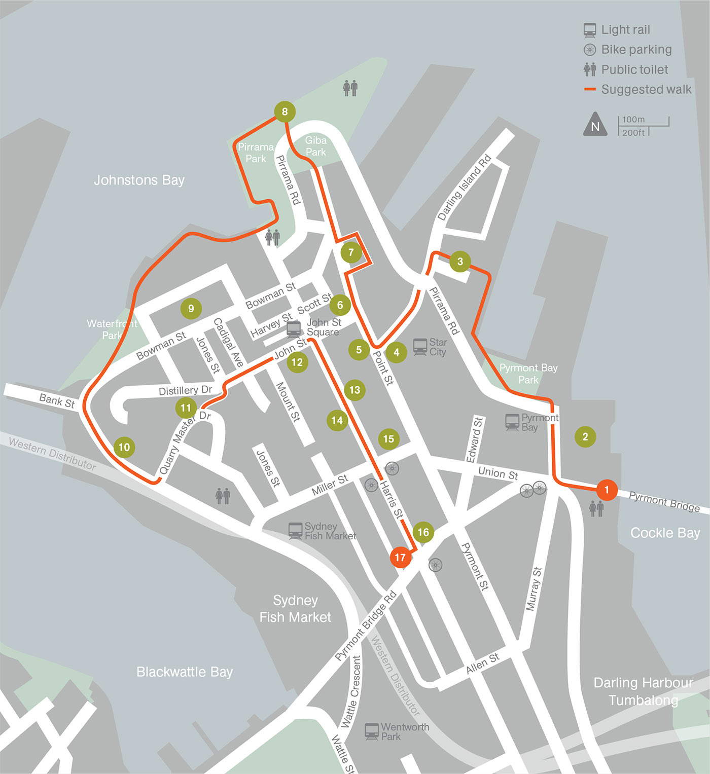
Download this map (PDF 1.1MB)
In 1806, what the Sydney Gazette described as a ‘select party of ladies and gentlemen’ came to this peninsula for a picnic. Its lush vegetation, and a ‘pure and unadulterated spring’ reminded one of the guests of the spa at Bad Pyrmont in Germany. John Macarthur, ex-officer of the NSW Corps, who had bought land here, adopted the name. By a curious coincidence, the members of the Gadigal people who then occupied the area called it Pirrama.
For most of the 19th and 20th centuries, the Pyrmont peninsula belonged to Sydney’s industrial heartland, with its wharves, goods yards, woolstores and factories contributing enormously to the city’s economic wealth.
Much of the area had become derelict by the 1990s, but developments on former industrial sites have led to an influx of new residents in recent years.
This tour visits key sites in the industrial and maritime history of Sydney, as well as exploring an often overlooked Sydney community. It is something of a ghost tour, as many of the sites no longer exist or have been put to other uses.
Allow about 2 hours for this walk.
Please note that there are steep inclines and stairs along the way.
Start at the western end of Pyrmont Bridge (1).
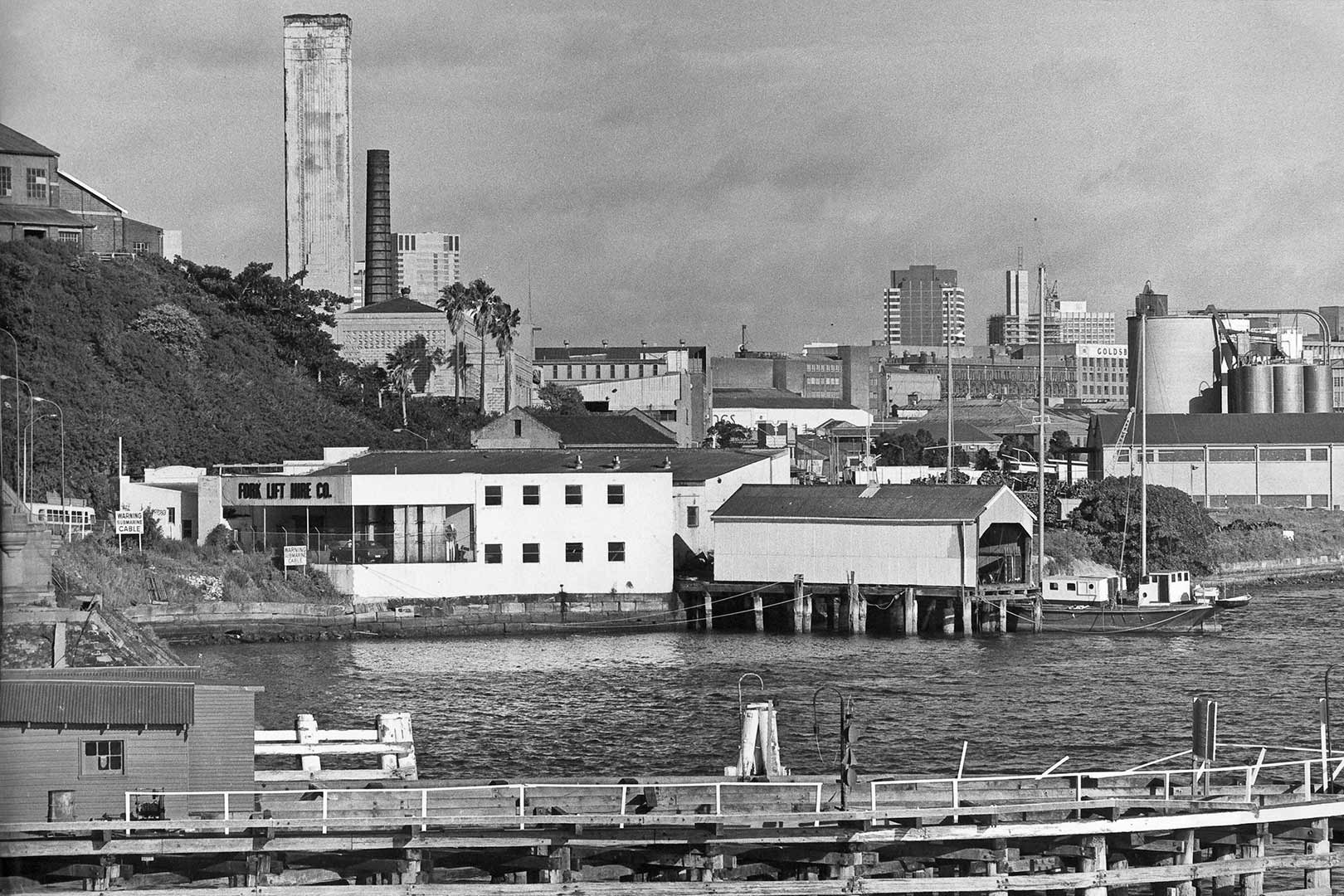
Image: Pyrmont Incinerator (also known as the Griffin Destructor) viewed from Glebe Island Bridge, 1976 (Photograph: Tim Collis-Bird / City of Sydney Archives)
Download this map (PDF 1.1MB)
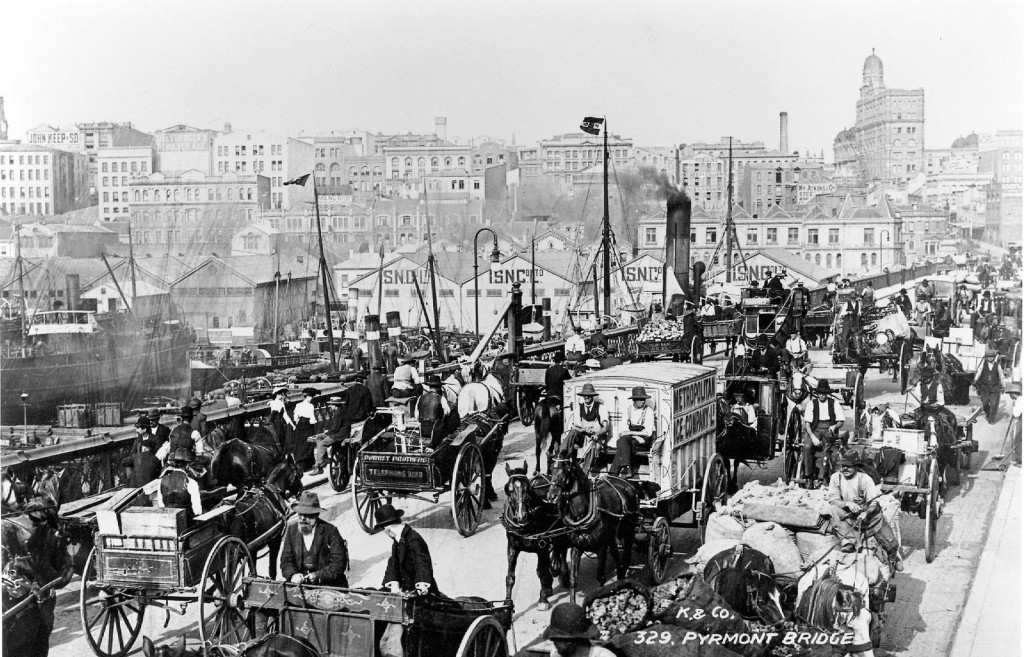
Pyrmont Bridge looking east towards the city, c.1904 (Photograph: City of Sydney Archives)
The first Pyrmont Bridge (1857) was a low wooden structure with a manually operated centre span. The current Pyrmont Bridge (1902) was once the main route west out of Sydney.
Although the 1902 bridge was closed to motor traffic in 1981, it was saved from demolition and now carries pedestrians to and from Darling Harbour. Because of its significance as one of the largest and earliest electrically operated swing bridges in the world, and because of the superb design of Percy Allan’s timber girder approach spans, Pyrmont Bridge was declared a National Engineering Landmark in 1992.
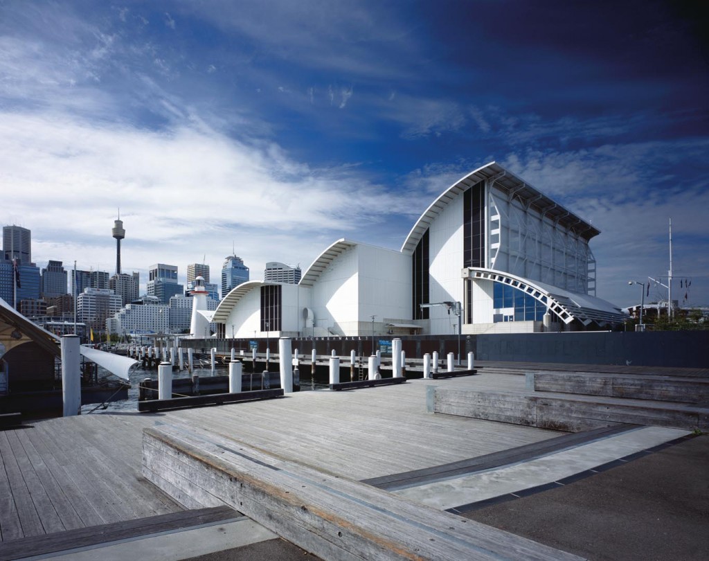
The Australian National Maritime Museum (Photograph: Patrick Bingham-Hall / Cox Architecture)
The Australian National Maritime Museum, opened in 1991, was designed by Philip Cox.
The high walls and diving roof forms were designed to accommodate the masts of boats displayed inside. The Museum also contains floating attractions including the ex-RAN Oberon class submarine Onslow, moored next to the Daring Class destroyer Vampire. Historic vessels visiting Sydney tie up here.
Turn right into Murray Street and walk through Pyrmont Bay Park. At the water’s edge are finger wharves, and the former Darling Island (3). The headland you can see across the water is Barangaroo.
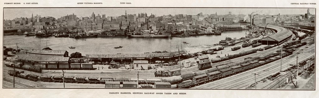
Darling Harbour, showing railway goods yards and sheds, c.1910 (Image: City of Sydney Archives)
In the 19th century, Darling Harbour was the site of a goods yards which became important in the 1870s with the growth of the wool industry and the construction of woolstores on the Pyrmont peninsula.
Other industries took advantage of the intersection of rail and shipping for exporting and importing, and by 1918 there were sidings all the way to the end of the peninsula as well as a rail loop (now the Sydney Light Rail).
The growth of road freight meant that by the early 1980s the great woolstores emptied, the goods yards fell into disuse, and businesses in the area languished.
Massive redevelopment of the area in the 1980s turned Darling Harbour into an exhibition, entertainment and tourist precinct which opened to the public during Australia’s Bicentennial celebrations in 1988.
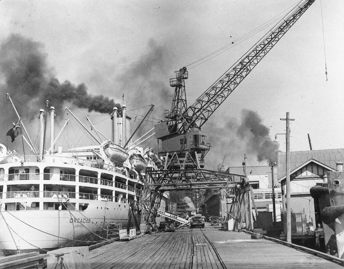
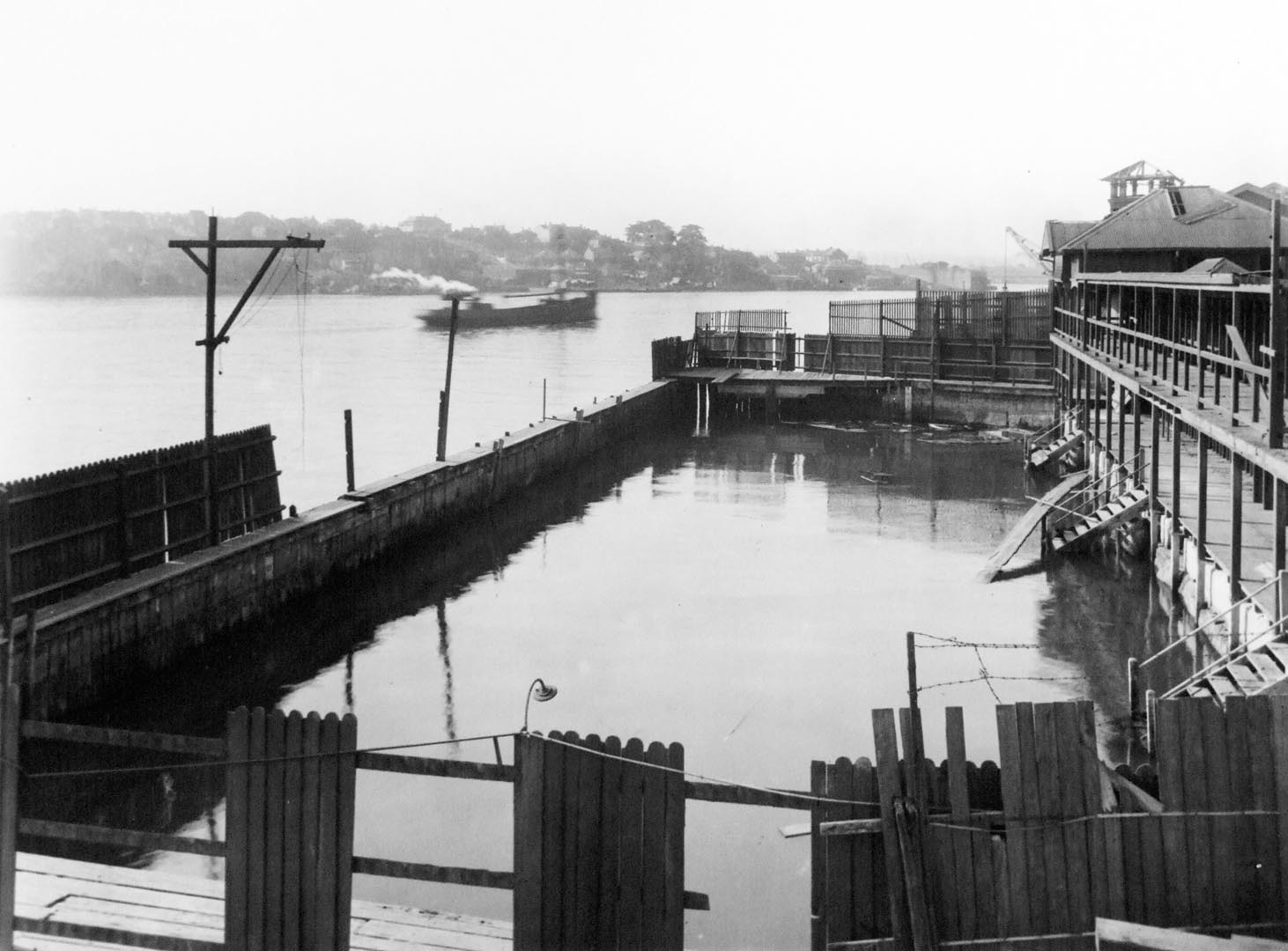
Docked ship at Darling Island, 1950 (Photograph: State Library of NSW)
Darling Island was originally separated from the mainland by a mud flat, which was first bridged by a causeway in the 1840s. From 1851, The Australian Steam Navigation Company occupied the island, steadily reclaiming land around the causeway, so that by the 1870s the island had become a peninsula.
Ships were built and repaired here until the 1890s. The NSW government purchased the site, and wharves and rail links were built to handle wheat and coal shipments.
From 1951 the wharf known as ‘Pyrmont 13’ was the first landfall in Australia for hundreds of thousands of post-war immigrants.
On the western side are two tall buildings built for the Navy between 1903 and 1912: the Ordnance Stores and the Royal Edward Victualling Yard.
Go up past the roundabout to the end of Jones Bay Road. On your left is The Star, on the site of the former Pyrmont powerhouse (4). Facing you is St Bede’s Catholic church (5).
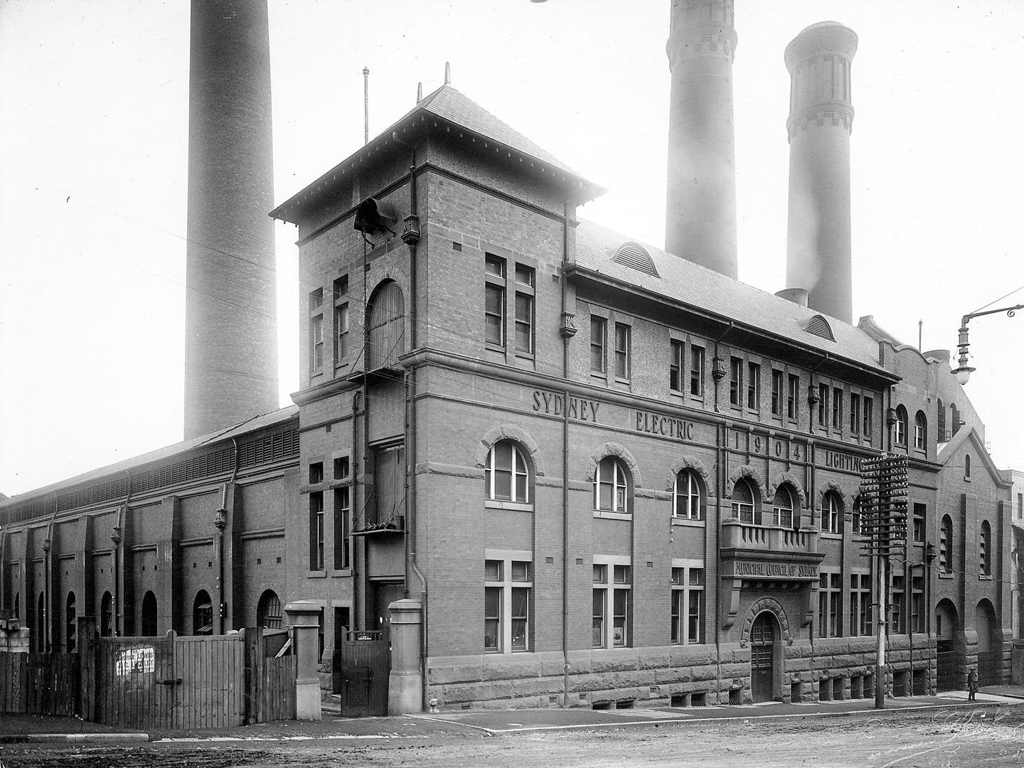
Pyrmont Powerhouse, 1919 (Photograph: City of Sydney Archives)
The Star casino and hotel is on the site of the Pyrmont powerhouse. The original façade of the powerhouse is preserved on Pyrmont Street. Sydney’s first electric street lights twinkled to life with the opening of the powerhouse in 1904.
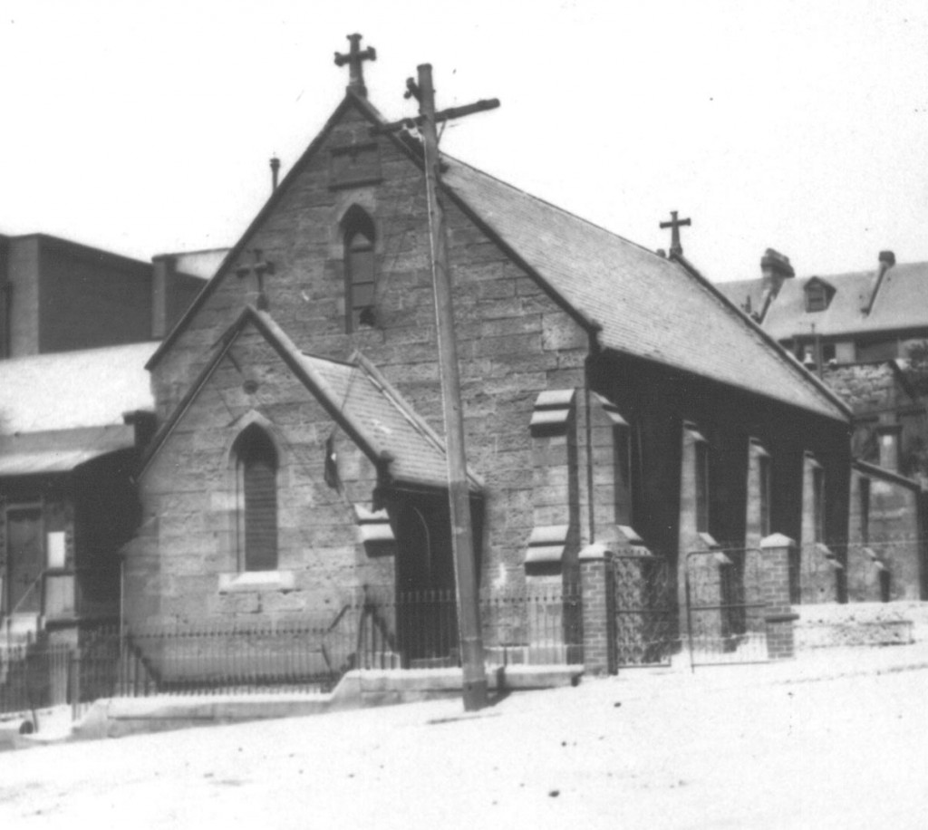
St Bede’s, Pyrmont (Photograph: Mitchell Library, State Library of NSW)
Most of the stone for the tiny St Bede’s was quarried locally. Catholic stonecutters, masons, builders and labourers worked on it voluntarily. Completed in 1867, St Bede’s was Pyrmont’s first Catholic church, and it has operated continuously ever since.
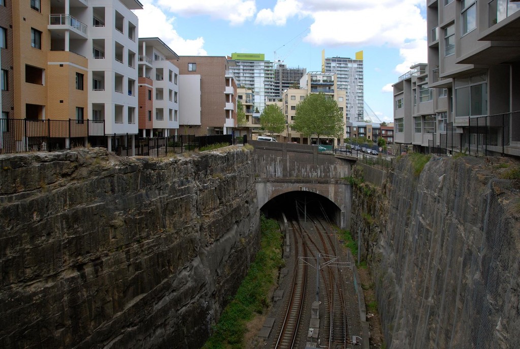
Walk uphill along Point Street. Past the intersection with John Street, pause to peer down at the railway cuttings (6) tunneling through the quarried sandstone peninsula.
Sydney Light Rail now uses the old freight rail system (Photograph: City of Sydney / Paul Patterson)
The Pyrmont railway cuttings and tunnel were part of the inner-city freight system that serviced the wharves from the mid-19th century until the 1980s. The Railways Department built this section in the early 20th century. Since 1996 the tracks have carried light rail commuters rather than wheat, wool and coal for export.
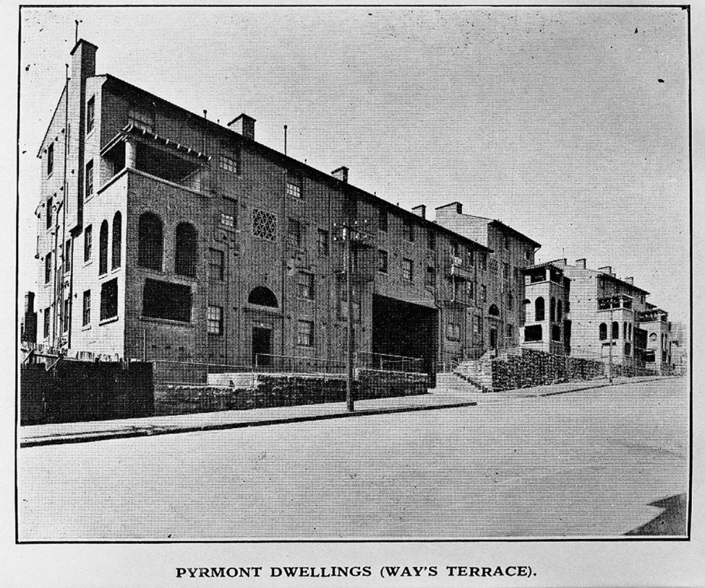
Ways Terrace c.1929 (Photograph: City of Sydney Archives)
The flats at 12-20 Point Street were built by the Sydney City Council in 1925 as workers’ housing. They were designed by prominent architect Professor Leslie Wilkinson in the inter-war Mediterranean style. Essentially unaltered since the 1920s, the Ways Terrace flats are still public housing. Locally they are known as the Point Street flats.
Take the pathway leading down the side of Ways Terrace for views of Jones Bay and the city beyond. This is James Watkinson Reserve, named after a local identity known affectionately during his lifetime as ‘Wocco’. More on him when we reach the former Pyrmont Baths (8). Follow Ways Terrace around to rejoin Point Street and walk to the end. From Giba Park, follow the ramps and stairs all the way down to the water’s edge.
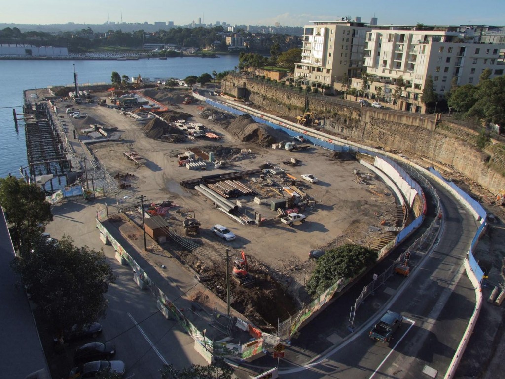
Pirrama Park under construction, 2008 (Photograph: City of Sydney / Paul Patterson)
Officially opened in 2010, Pirrama Park encompasses what used to be called Pyrmont Point Park to the east, and the former NSW Water Police site to the west. In 2003, as the Water Police awaited the completion of their new accommodation across the water in Balmain, a vigorous community campaign in Pyrmont got underway, opposing plans for the redevelopment of the site as high-rise apartments. The campaign was successful. In the 2005, the City of Sydney acquired the land and preserved it as public, recreational space. Pirrama Park has won several awards for architecture and landscape design. The foreshore esplanade traces Pyrmont’s original shoreline, and the park offers a range of ways for visitors to experience and engage with the element of water.
At the western end of Pirrama Park, a tall building with a red brick, art deco façade addresses the bay. Now accommodating waterfront apartments, this building was once the grimy, high-pressure boiler house of a major industrial operation, the Colonial Sugar Refinery.
Derelict Pyrmont Baths, c.1929 (Photograph: City of Sydney Archives)
At the water’s edge, the kink in the boardwalk marks the spot of the much loved but ill-fated Pyrmont Baths: an icon of working class, industrial Pyrmont.
In 1872, Pyrmont residents petitioned the council for the construction of public baths, which opened in 1877. The pool was tidal, and the floor was sand. It became a central meeting place for the amenity-starved residents of Pyrmont and Ultimo. One identity associated with the baths was James Watkinson (1888-1954). A champion athlete who lived on Bowman Street, he taught hundreds of children to swim and was a driving force in the emergence of Pyrmont as a dominant water polo and swimming club in NSW. When the baths were threatened with demolition in 1929, ‘Wocco’ helped save them.
The locals took over the administration, and kept the baths going for another 17 years, but without municipal funding they fell into disrepair and were finally demolished in 1946.
Follow the foreshore around to the west. Past Pirrama Park, a tall building with a red brick, art deco façade addresses the bay. Now accommodating waterfront apartments, this building was once the grimy, high-pressure boiler house of a major industrial operation, the Colonial Sugar Refinery.
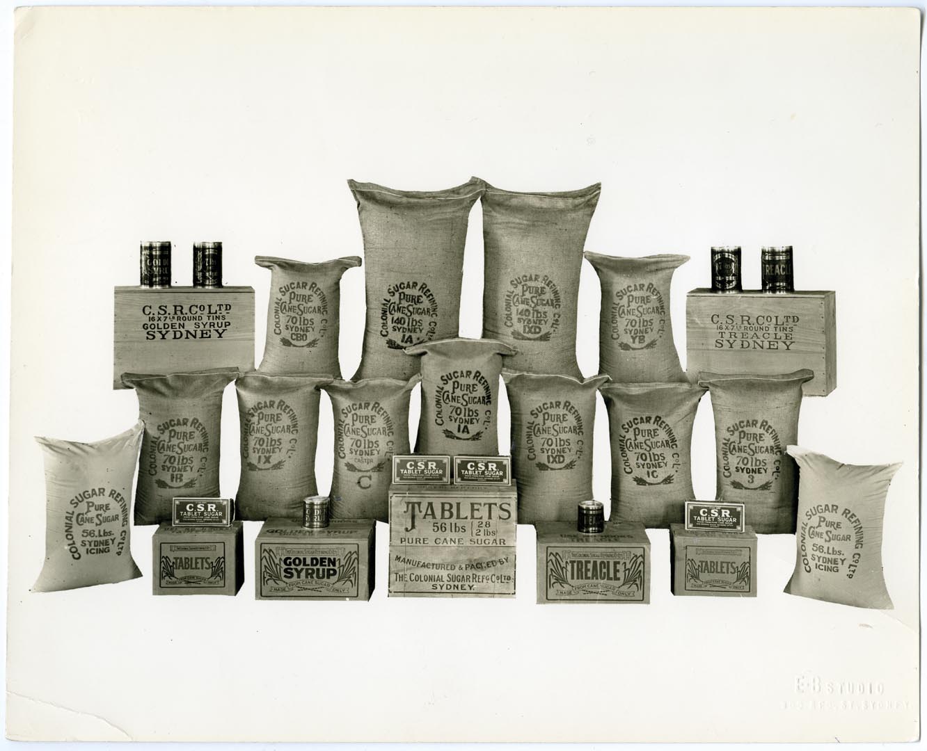
Refined sugar products from CSR, c.1940s (Photograph: Noel Butlin Archives Centre: CSR Ltd 171-875)
The Colonial Sugar Refining Company first acquired land at Pyrmont in 1878, and eventually owned 31 acres (12.5 hectares). Houses and streets disappeared as CSR expanded.
The company provided thousands of jobs, some of them unpleasant and dangerous. Products included not only sugar, golden syrup and molasses from the refinery but industrial alcohol and rum from the distillery, and particle board from the Caneite factory. Street names in this area owe much to CSR operations, which were finally wound down by the early 1990s.
Much of the former CSR site is now occupied by the Jacksons Landing residential development. Look out for interpretative signs in the precinct.
Continue west along the foreshore, and keep an eye out for three enormous rusted steel digesters installed in Waterfront Park. These were salvaged from the CSR Caneite factory where they were used in the manufacture of hardboard. At the end of the foreshore walk, join Bank Street. Where now residential apartments clamour for water views, the ‘Griffin Destructor’ (10) used to belch foul pollution across an industrial landscape.
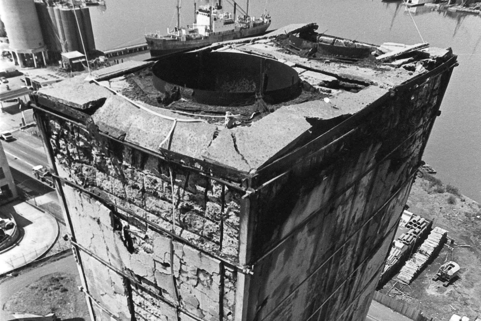
Pyrmont Incinerator (also known as the Griffin Destructor), 1976 (Photograph: City of Sydney Archives)
The residents of Pyrmont already had to deal with smoke from the Pyrmont and Ultimo powerhouses when in 1932 the Sydney City Council decided to build its new garbage incinerator at Pyrmont. The incinerator was designed by Walter Burley Griffin, the designer of Canberra, and his wife Marion Mahony Griffin, and was a stunningly modern cubist-inspired building with richly decorative detailed work based on Aztec motifs.
It was decommissioned in 1971 and fell into disrepair, then was demolished in 1992 to make way for the large block of home units that now occupies the site. Previously in this area was Tinker’s Well, where Aboriginal people continued to camp and gather oysters and cockles as late as the 1830s. It was one of the landmarks that disappeared as the cliffs were quarried back.
Cross Bank Street and walk up Quarry Master Drive until you reach a landscaped escarpment. Follow the cliff-face a few metres around to the left to inspect a face of ‘yellow block’ sandstone, once part of Saunders’ ‘Paradise’ quarry (11). Saunders’ quarrying operations were awarded a Historic Engineering Marker in 2005 and are commemorated here with a plaque.
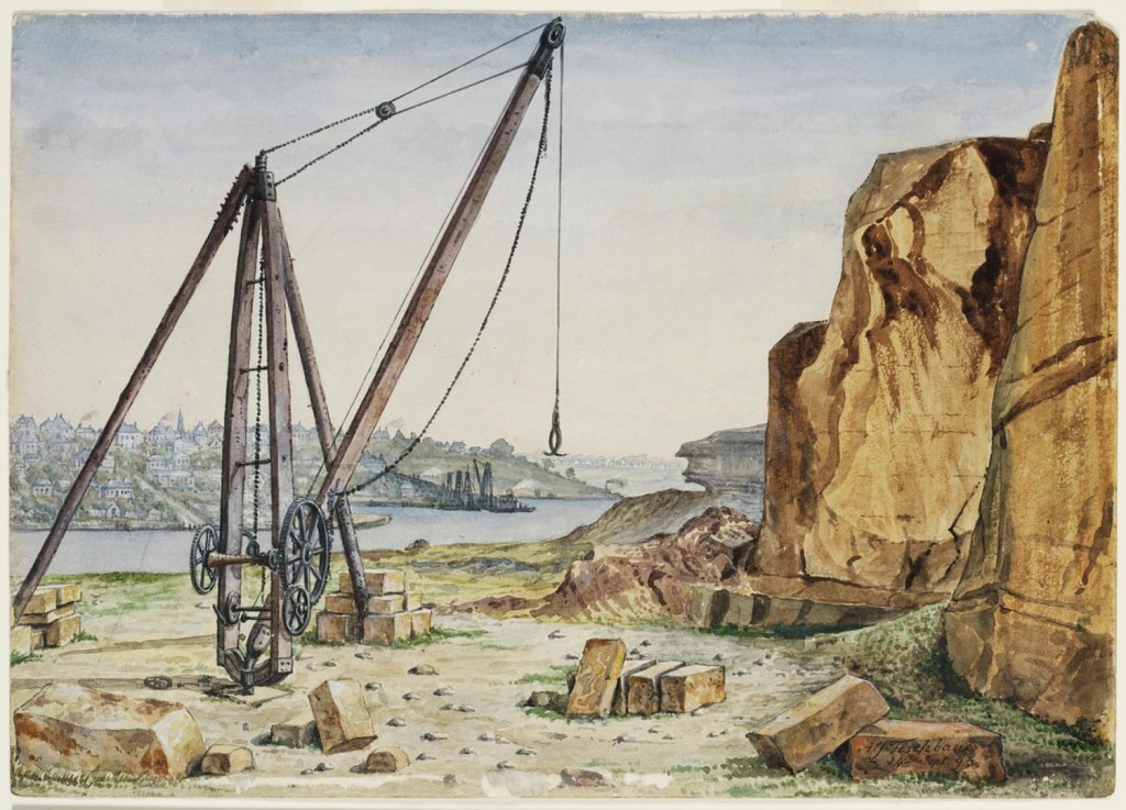
Pyrmont Quarry 1893 (Watercolour: Alfred Tischbauer / State Library of NSW)
The tough quality of Pyrmont sandstone was well known by 1855. When the entrance and steps of the Australian Museum had to be replaced, the Colonial Architect insisted that the stone must come from the ‘best bed of the Pyrmont quarries’.
Buildings using Pyrmont stone include Sydney University, the General Post Office and the Art Gallery of NSW, along with many other government buildings, insurance companies and banks. The quarries provided many jobs, but contributed to changing the peninsula from an attractive retreat to a place with a blasted, treeless appearance. ‘Paradise’ was one of several quarries run by the Saunders family. ‘Purgatory’ and ‘Hell Hole’ were further south on the peninsula.
Ascend the stairs or ramp. At the top, turn right into John Street.
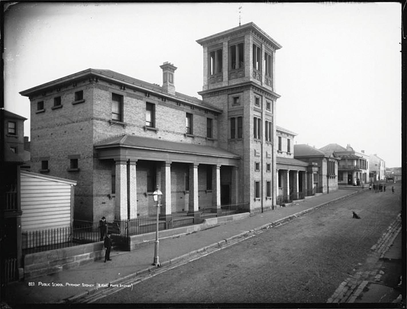
Pyrmont Public School, c.1900 - (Photograph: Henry King / Museum of Applied Arts and Sciences)
Built in 1892, the school was designed by William Kemp, the noted schools architect who also designed the Sydney Technical College and the Technological Museum a few blocks away in Ultimo.
As well as education, the school provided amenities. It was only at school that many children were able to have showers and proper baths, and the building of the school gymnasium in 1919 was a boon to the budding champion athletes of Pyrmont. But from a peak of 650 students in 1920, the number fell to 245 in 1933 as houses were demolished for woolstores and flour mills, and the school was closed. It is now a community and child care centre.
Continue along John Street then turn right into Harris Street.
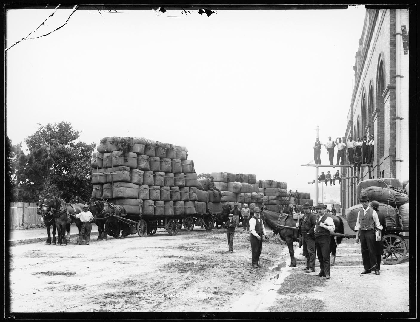
Loading wool at Winchcombe Carson woolstore, Pyrmont, 1897 (Photograph: Charles Kerry Studio / Tyrrell Collection, Museum of Applied Arts and Sciences)
The Schute, Bell, Badgery and Lumby woolstore at 100 Harris Street was built in 1919 in the Federation Warehouse style.
Today, it is just one of many former woolstores on the Pyrmont peninsula; other excellent examples lie further up Harris Street. Their scale and architectural detail reflect the importance of wool to the Australian economy from the 1880s to the 1960s. Collectively these buildings show that Pyrmont was once the centre of a thriving wool exporting industry.
By the beginning of the 1970s, Pyrmont’s woolstores had begun to empty as the wool brokers relocated activities to the new Yennora Wool Centre west of Parramatta. From the 1990s, most were redeveloped as residential apartment buildings.
Maybanke Children’s Playground c.1930s with CSR hostel at rear (Photograph: City of Sydney Archives)
Maybanke Kindergarten opened in 1924 in a building which had previously been a chapel in the grounds of Clifton House, home of quarrymaster Charles Saunders. The kindergarten was named after Sydney suffragist and education reformer Maybanke Anderson (1845-1927) who pioneered the free kindergarten movement in Australia during the depression of the 1890s.
By looking after the education and welfare of children in slum areas, free kindergartens were an enlightened approach to social reform. This was the first free kindergarten in Pyrmont.
(Photograph: Patricia Baillie / City of Sydney Archives)
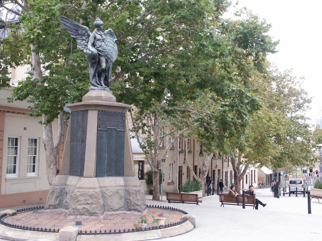
The Pyrmont-Ultimo war memorial was unveiled on 8 April 1922 by NSW Governor Sir Walter Davidson. It stood in the little square at the corner of Union and Harris streets, where there had previously been a flowerbed. The memorial was funded by the local community. Of the 750 local men who enlisted during World War I, 150 died and many more were wounded. All are recorded on the memorial, which is topped by an angel of peace.
Walk south along Harris Street to Pyrmont Bridge Road.
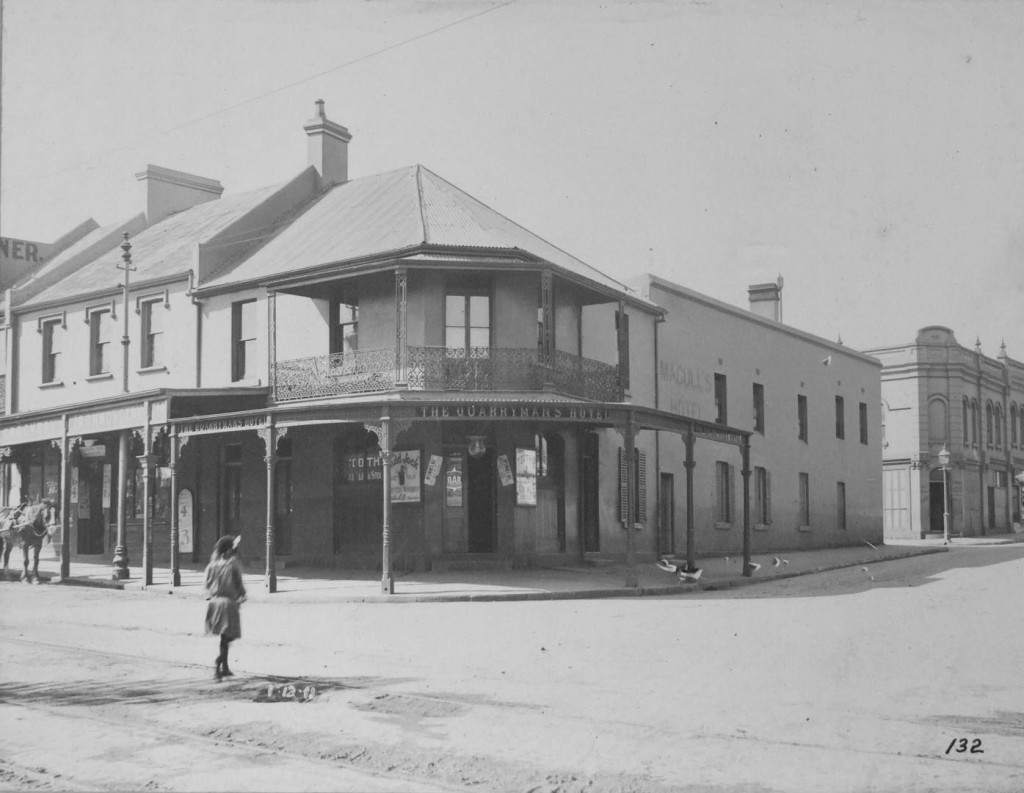
Quarryman’s Arms, 1911 (Photograph: City of Sydney Archives)
The Pyrmont peninsula once boasted 25 pubs, with each industrial concern and wool store having its own associated hotel. The name of the Quarryman’s Arms (16) is a reminder of one the earliest major industries on the Pyrmont peninsula.
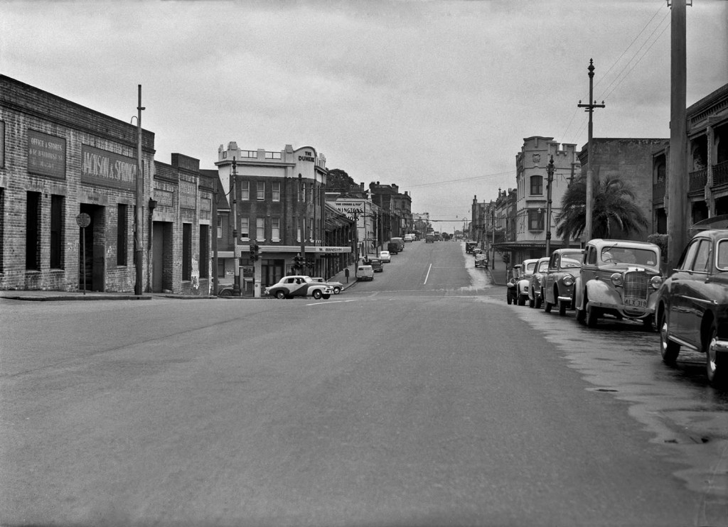
View north along Harris Street in 1955 with the Dunkirk Hotel on the left (Photograph: City of Sydney Archives)
The Dunkirk Hotel (17) was originally known as the Butcher’s Arms, while nearby Bank Street was once known as Abattoir Road.
Your walk ends here.